Neighboring Countries of India
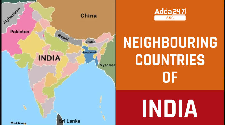
Do you know what are the neighboring countries of India? India is a country that is located in southern Asia. India is the second-most populous country in the world after China. India is also the 7th largest country in the world in terms of area. India is covered by the Indian Ocean on the south, the Arabian Sea on the southwest, and the Bay of Bengal in the southeast. India has a total land border of 15,106.7 Km and a coastline of 7,516.6 Km including island territories. Neighboring countries of Indian include Afghanistan and Pakistan in North-West, China, Bhutan, and Nepal in the north, Bangladesh in the east, and Myanmar in the far East. Neighboring countries of India with sea borders include Sri Lanka in the southeast and Maldives in the southwest. In this article, we are providing the list of neighboring countries of India and details about them. This article will help students in enhancing their general knowledge and will help them in dealing with the questions related to the Geography of India.
Neighboring Countries of India: Bordering States
There are a total of 9 neighboring countries of India out of which 7 share their land borders. The list of states that share the borders with respective countries is given below.
| Neighboring Country | Bordering States |
|---|---|
| Pakistan | Jammu and Kashmir, Punjab, Gujarat, and Rajasthan |
| Afghanistan | Jammu and Kashmir (POK Part) |
| China | Jammu and Kashmir, Himachal Pradesh, Uttrakhand, Sikkim, and Arunachal Pradesh |
| Nepal | Sikkim, West Bengal, Bihar, Uttar Pradesh, and Uttrakhand |
| Bhutan | Arunachal Pradesh, Assam, Sikkim, and West Bengal |
| Bangladesh | West Bengal, Mizoram, Meghalaya, Tripura, and Assam |
| Myanmar | Arunachal Pradesh, Manipur, Mizoram, and Nagaland |
| Srilanka [Sea border] | An island nation in the Indian Ocean, southeast of the Indian subcontinent |
| Maldives [Sea Border] | An island country in the Indian Ocean, South Asia, south-southwest of India. |
Here is the detailed list of neighboring countries of India including all India border countries with flags of neighboring countries of India.
1. Pakistan
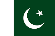
Pakistan is located to the west of India and is one of the India border countries. Pakistan has a coastline along the Arabian Sea and the Gulf of Oman. The total land area of Pakistan is 7,96,095 sq km. The Indian states which share a border with Pakistan include Gujarat, Rajasthan and Punjab, and the Union Territory of Jammu and Kashmir. Pakistan separated from India after India got its independence from British rule. Pakistan celebrates its Independence Day on August 14, 1947. After the Independence, Pakistan was formed into two territories i.e. East Pakistan and West Pakistan. These two territories were geographically and culturally apart from each other. After a long conflict between these two, in 1971 a civil war occurred, as the result of which Bangladesh was formed. West Pakistan lying in the northwest of India became the Republic of Pakistan and East Pakistan became Bangladesh.
| President | Arif Alvi |
| Prime Minister | Shehbaz Sharif |
| Official languages | Urdu, English |
| State/ Provinces | 4 Provinces |
| Capital | Islamabad |
| Currency | Pakistani Rupee |
| National Game | Field Hockey |
| National Bird | Chukar partridge |
| National Fruit | Mango(Summer), Guava (Winter) |
| National Tree | Deodar |
| National Anthem | Quami Tarana |
| Highest peak | K2 |
| Longest river | Indus River |
| Religion | Islam |
| Parliament | National Assembly (342 seats) |
| Border | Radcliffe Line |
2. Afghanistan
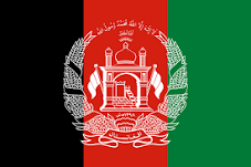
Afghanistan is also known as the Islamic Republic of Afghanistan in Central Asia. The total land area of Afghanistan spreads across 6,52,230 sq km and is known. Islam is the predominant religion in the country and the major dependence of the country’s economy is on Agriculture. Countries near India include industrial activities in Afghanistan including the manufacturing of cotton textile, woolens, woven carpets, and handicrafts. Pakistan-occupied Kashmir shares a border with Afghanistan.
| President | Ashraf Ghani (Former) |
| Parliament | Wolesi Jirga (Lower House) (250 members) |
| Official languages | Dari and Pashto |
| State/ Provinces | 34 Provinces |
| Capital and largest city | Kabul |
| Currency | Afghan afghani |
| National Game | Buzkashi |
| National Bird | Grey Peacock-the Golden eagle |
| National Fruit | Prunus persica |
| National Tree | Afghan Pine |
| National animal | Snow Leopard |
| Border | Durand Line |
3. China
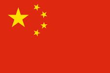
The people’s Republic of China is located in East Asia and other Indian border countries. It is the most populous country in the world and also the 4th largest country in the world. The President of China is the head of the state. China lies to the north of India. Indian states that share their borders with China are Ladakh, Himachal Pradesh, Sikkim, Arunachal Pradesh, and Uttarakhand. China is one of the fastest-growing economies in the world. Both countries are connected by the Silk Road initiative and the exchange of Buddhism religion.
| President | Xi Jinping |
| Official languages | Mandarin |
| State/ Provinces | 26 Provinces |
| Capital | Beijing |
| Currency | Chinese Yuan (CNY) |
| National Game | Table Tennis |
| National Bird | Red-crowned crane |
| National Fruit | Kiwifruit |
| National Tree | Maidenhair tree |
| National Flower | Bluewater lily |
| National animal | Giant Panda |
| Longest river | Yangtze River |
| Boundaries | Jammu and Kashmir, Himachal Pradesh, Sikkim, Uttarakhand, and Arunachal Pradesh |
| Parliament | National Assembly (2980 members) |
| Border | McMahon Line |
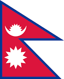
Nepal, officially known as the Federal Democratic Republic of Nepal is a landlocked country. Nepal is located to the north of India. In terms of area, Nepal is the 93rd largest country in terms of land with an area of 1,47,181 sq km. The capital of Nepal is Kathmandu which is also the largest city in the country. Nepal has eight of the ten tallest mountains in the world world, including the highest point on Earth, Mount Everest. Tourism is one of the biggest contributors to the country’s economy. Nepal shares borders with Uttarakhand, Uttar Pradesh, Sikkim, West Bengal, and Bihar.
| President | Bidhya Devi Bhandari |
| Prime Minister | Pushpa Kamal Dahal |
| Official languages | Nepali |
| State/ Provinces | 7 Provinces |
| Capital and largest city | Kathmandu |
| Currency | Nepalese rupee |
| National Game | Volleyball |
| National Bird | Himalayan monal (Lophophorus impedance) |
| National Animal | Cow |
| National Tree | Ficus religiosa |
| National Flower | Rhododendron |
| Highest peak | Mount Everest |
| Longest river | Karnali |
| Parliament | The National Assembly (275 seats) |
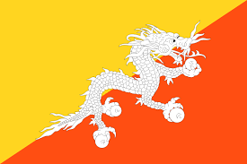
Bhutan is situated to the north of India. It is officially known as The Kingdom of Bhutan and shares a border with the Indian states of Arunachal Pradesh, Sikkim, Assam, and West Bengal. It is also a landlocked country and has an area of 38,394 sq km. The capital of Bhutan is Thimphu. The country has a constitutional monarchy. The major contributors to the economy of the country are Hydropower, agriculture, forestry, and tourism. Bhutan is the smallest neighboring country of India.
| Name of king | Druk Gyalpo (Dragon King) |
| Monarch | Jigme Khesar Namgyel Wangchuck |
| Prime Minister | Lotay Tshering |
| Upper house | National Council |
| Official languages | Dzongkha |
| State/ Provinces | 20 states |
| Capital and largest city | Thimphu |
| Currency | Ngultrum (BTN) |
| National Animal | Takin |
| National Bird | The Raven |
| National Game | Archery |
| National Tree | Cypress(Tsenden) |
| National Flower | Blue poppy |
| Religion | 77.4% Vajrayana Buddhism, 22.6% Hinduism |
| Lower house | National Assembly (Tshogdu) 55 seats |
6. Bangladesh
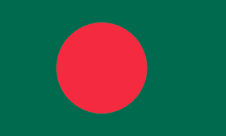
Bangladesh officially called the People’s Republic of Bangladesh is situated in South Asia. Neighbors of India, Bangladesh shares one of the longest borders in the world. The capital of Bangladesh is Dhaka. Indian states of Assam, Mizoram, Tripura, Meghalaya, and West Bengal share their border of Bangladesh. Bangladesh is the eighth-most populous country in the world (161 million) and also one of the most densely populated countries in the world. Bangladesh was initially a part of Pakistan and was known as East Pakistan but after the 1971 Liberation War took place, it gained independence.
| President | Abdul Hamid |
| Prime Minister | Sheikh Hasina |
| Official languages | Bengali |
| State/ Provinces | 8 Provinces |
| Capital | Dhaka |
| Currency | Bangladeshi Taka |
| National Game | Volleyball |
| National Bird | Oriental Magpie-Robin |
| National Fruit | Jackfruit (kathal) |
| National Tree | Mango Tree |
| National animal | Royal Bengal tiger |
| Highest peak | Keokradong |
| Longest river | Surma |
| Religion | 70.2% Buddhism, 12.6% Hinduism |
| Parliament | Jatiyo Shangsad (Bengali) and House of the Nation(English) (350 Member) |
| Border | Radcliffe Line |
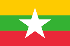
Myanmar, also known as Burma, officially known as The Republic of the Union of Myanmar is situated in East Asia. One of the neighbors of India Myanmar shares its border with the Indian states of Nagaland, Mizoram, Arunachal Pradesh, and Manipur. Myanmar has an area of 6,76,578 sq km and is the largest of the Mainland Southeast Asian states. Naypyidaw is the capital of Myanmar. The military is now back in charge and has declared a year-long state of emergency. Military commander-in-chief Min Aung Hlaing has taken power. He has long wielded significant political influence, successfully maintaining the power of the Tatmadaw – Myanmar’s military – even as the country moved towards democracy.
| Prime Minister | Min Aung Hlaing, |
| National anthem | Kaba Ma Kyei |
| Official languages | Burmese |
| National animal | Tiger |
| Capital and largest city | Naypyidaw |
| Currency | Burmese Kyat |
| National Game | Cannibal |
| National Bird | Grey Peacock-Pheasant |
| National Fruit | Padauk |
| National Tree | Green Peafowl |
| Parliament | The House of Representatives (440 seats) |
| Highest peak | Hkakabo Razi |
| Longest river | Irrawaddy River |
| Famous festivals | Thingyan, Kasone, Nayon |
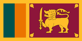
Sri Lanka officially known as the Democratic Socialist Republic of Sri Lanka lies near the southern area of India and is separated by Palk Strait. Sri Lanka has two capital, the commercial capital of the country is Colombo where on the other and Sri Jayewardenepura Kotte is its legislative capital of the country. The president is the chief of state and the head of government in the country. It is located in the Indian Ocean to the southwest of the Bay of Bengal and to the southeast of the Arabian Sea. Being an island nation, Sri Lanka is a choice of many and makes a pleasant tourist destination in the world.
| President | Ranil Wickremesinghe (2023) |
| Prime Minister | Dinesh Gunwardena |
| Official languages | Sinhala, Tamil |
| State/ Provinces | 9 states |
| Capital and largest city | Sri Jayawardenepura Kotte |
| Currency | Sri Lankan Rupee (LKR) |
| National Game | Volleyball |
| National Bird | Ceylon (Jungle Fowl) |
| National Fruit | Jackfruit |
| National Tree | Ironwood |
| National Flower | Bluewater lily |
| Highest peak | Pidurutalagala |
| Longest river | Mahaweli |
| Religion | 70.2% Buddhism, 12.6% Hinduism |
| Parliament | Parliamenthua (225 seats) |
| Famous festivals | Sinhala and Tamil New Year, Vesak, Poson Festival, Kandy Esala Perahera, Kataragama Festival, Vel Festival, Deepavali |
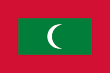
The Maldives is an island nation situated in the southwest of India officially the Republic of Maldives. Area wise it is one of the smallest countries in the world. It is spread over 298 sq km only. The Maldives has more than a thousand coral islands. The Maldives is a presidential republic and the president is the head of the state. The capital of Maldives is Male.
| President | Ibrahim Mohamed Solih |
| Parliament | People’s Majlis |
| Official languages | Dhivehi |
| State/ Provinces | 1 Only |
| Capital and largest city | Male |
| Currency | Maldivian Rufiyaa |
| National Game | Football |
| National Bird | White-breasted Waterhen |
| National Fruit | Coconut |
| National Tree | Coconut Tree |
| National animal | Yellowfin Tuna |
Neighboring Countries of India and their Capitals
The capitals of all neighboring countries of India are given below. Here is the list of neighboring countries of India & their capitals:-
Also read,
Source link

